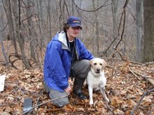
Hiking Old Rag
Here is a link to my recent hike of Old Rag.
http://www.christophermoule.com/2009/07/hiking-old-rag/
Here is a link to my recent hike of Old Rag.
http://www.christophermoule.com/2009/07/hiking-old-rag/
When I go out camping and hiking I like to keep the amount of gear I have to carry to a minimum. I recently discovered an new innovation, the Sea to Summit mug and bowl. When you are not using them the mug fits inside the bowl and the result is a disc four inches in diameter by 1/4" thick. To use either of them you push out the centre of the disc and you are ready to go. Before putting the mug to a test in the wilderness I decided to test it out in my kitchen. I added my favourite hot brew to the mug and discovered that it is best to the grip the cup by the black rim and to use two hands when drinking say a cup of hot coffee or tea. I was impressed by how well they worked. The next test will be to see how they operate in the arctic cold of Adirondack winter camping or a local trek in the Ottawa environs.
http://www.rei.com/product/767560 Sea to Summit bowl
http://www.rei.com/product/787278 Sea to Summit X-Mug
I spent last weekend having an incredible great time in Baltimore. I arrived on Friday afternoon and Jason met me at the airport. We headed over to Whole Foods for a late lunch as I was famished. After lunch we headed back to Jason’s place to chip away at a layer of cement in his bathroom as earlier in the week the bathroom tiles didn’t set properly. Having two hammers and chisels beaver away at the floor allowed us to nearly get the floor free of cement debris 1 2 . In the evening we headed south to Glen Echo, which is south-west of Washington for some swing dancing. Jam Cellar and Sac au Lait were hosting an outdoor dance in the old bummer car pavilion. It was a great venue and the music was good.
On Saturday, we headed back to Jason’s house and spent much of the morning scouring the bathroom floor of cement so that Em could lay the tiles in the afternoon. In the afternoon Jason grouting another bathroom and I was cool to act as a support person doing chores for Jason and Em. In the evening we headed over to Camden Yards to take in an Orioles game. It game started late as the “O’s” were playing a double-header. We had great seats and we watched a good game despite the fact that “O’s” lost.
We started off Sunday with a large breakfast (home-made waffles) at Jason’s parents place. Jason gave me some tips on how to get my Yahoo Mail on my iPhone/iPod Touch which was really good. Afterwards, we headed to REI as I had an order that needed to be picked up. I was able to buy two BPA free Nalgene bottles which was sweet. We next headed in a North-Western direction to the Catochin Mountains close to Thurmont, MD. Much of the day was spent hiking and doing some light climbing. I was happy to watch Jason scale some steep rock faces. (Note to self – I should have brought my climbing shoes and harness.) (Wolf Rock n39 38.042 w077 26.258) There was a little exciting when we were at Wolf Rock. I found a crevasse in the some rocks which allowed me to lay back and to take and get in some R&R. Once Jason had climbed Wolf Rock he set his eyes on a more ambitious goal of seeing his could climb through a rock face underneath me. He got very close to the surface only to find he couldn’t get his chest through a small crevasse. What to do? The only solution was to head back down the way he came. It was a hot day and the rocks were slippery. As he was heading down Jason lost his grips and fell 15 feet bouncing from one rock to another. It was a WOW moment. A little later we headed south back to Em’s place for an awesome lasagna dinner with family friends.
http://picasaweb.google.ca/moulec/Baltimore_Sept_2008#
On Monday, Scott, Jason and I headed over to Home Depot to get some Hardi-backer flooring boards. I had estimated that we would need 14 boards by measuring the area and adding in an error factor (15%). After lunch we laid down the cement, Hardi-backer boards, and screwed in 850 screws. Having three people working on the task meant that we always had a ready-supply of cement, some putting in the screws while someone else was measuring the next board. In the evening we headed to the Austin Grill for some swing dancing. I head a great time dancing while many folks that I had danced with before. We close out the evening doing something quite memorable and that is playing wordabble on our ipod Touch/iPhone.
On Tuesday, we had a leisurely morning which was great. We exchanged gifts and I’m pleased with my JetBoil. For lunch we headed to Rosina’s which is a sort of tradition. In the early afternoon I headed back to Ottawa by way of Philadelphia.
Today I was geocaching in the Greenbelt of Ottawa and trying to locate some caches in deer yards. As I was walking to my next cache I heard a branch crack and stopped dead in my tracks. This could have been a good or bad decision. If a tree or branch was falling I was going to get whacked. I was lucky as whatever made the noise stopped too. Through the cedar underbrush I could see that I was five feet away from a deer. We stared at each other for a while and then it flicked it tail and was off on its way. A little later on I spotted another one heading away in the distance. My current find tally is 875 and so my goal of 900+ finds by the end of the year is quickly coming within sight.
Wright Peak/Algonquin/Iroquois/Phelps/Colden
Friday June 27
One of my goals is to eventually climb all of the 46 peaks in the Adirondacks whose elevation is above 4,000 feet. This past weekend I added one more to the tally, Iroquois. On Friday morning, Chris Mc and I headed down to Lake Placid and stopped in at the Price Chopper to get lunches and groceries for the long weekend. Once at camp we setup a tarp and bug net over the picnic table as suspected we would meet the bugs and/or rain over the weekend. Na, Paul and Ben would arrive at the campsite a little while later. After supper we started a fire and contemplated when Wendy and Erin would arrive. We took bets on when they might arrive and I won. They wouldn’t arrive until mid-afternoon on Saturday.
Saturday June 28
The five of us were up early (0630) and eating breakfast by 7:00 AM. Our goal for the day was to hike the mountains near Algonquin Peak much of this would be dependant on our stamina and the weather. At 8:21 AM we headed out from the ADK Loj trailhead and made our way south-west. After 30 minutes the trail splits, one direction leading to Marcy Dam and the other to Algonquin. We took the right path and headed south. The trail very gradually climbs and is a Mecca for boulders. Along the way we took in the sight of a waterfall. After climbing for about an hour we reached another trailhead. Half of the group climbed Wright Peak while the others continued on the trail to Algonquin. The view from Wright was good but we could see a storm approaching in the distance. As continued our ascent up to Algonquin it started to lightly rain and in rolled the mist. It was hard to spot the next cairn. We stopped for lunch at the summit. The mountain steward was standing on watch. The group split again and most of the people headed down Algonquin. The remainder continued east to Boundary and Iroquois. The intensity of the rain increased and the fog grew thicker. It was at this point that the GPS proved its value. At breakfast time I punched in the coordinates for all the peaks we would be climbing. A father, his son and a large poodle mistook Boundary for Algonquin. I shouted that the GPS said we had another 300 yards to hike. They were not happy by this remark. The final 300 yards involved hiking through shoulder height trees and boggy mud flats. My knee high gators kept the spruce trees from scratching my legs as well as keeping the mud away from my boots. Once we reached the summit we retreated back to the valley between the mountains. We had a choice to head back by Avalanche Lake or return the way we had come. Three groups were making the same decision and all opted for coming back the way they had come. It would be better to head back on familiar terrain that to take a longer route with an uncertain terrain. The constant rain made this choice obvious. As we headed across Algonquin the rain became more intense and my heart went out to the steward huddled next to a large rock. It would be another three hours before he could head down. Once below the tree line the rain let up and we could take off our rain jacket. The forest was steamy hot. A little while later the sun came out. As we were heading by the falls I saw some naïve hikers making there way to Wright Peak. They were wearing button-down white and blue shirts. I wonder how long they would stay clean and dry as another storm was an hour away. Once back at the camp I had a piping hot cup of tea to celebrate my ascents. Wendy and Erin had arrived by this point and prepared a marvelous pasta dish for supper. Paul and I trimmed up a standing conifer tree and as a standing dead tree is a dry tree. A blazing warm fire was a welcome site to the group.
Sunday June 29
Most of the group was awake at sunrise and we started down the trailhead early in the morning. Our goal was to climb Phelps. At the first trail junction we headed east towards Marcy Dam and took in the sights before heading further east. There was much relief as we were climbing the Phelps trail as it had fewer rocks than the trail leading to Wright. We ate lunch at the Phelps summit. The knats and black flies were swarming on the summit so we headed down shortly after lunch. We were at our campsite by mid-afternoon. After a Chinese stir-fry meal we headed into B&J for ice cream. There were black clouds hanging over Lake Placid. As we were heading back to camp it started to pelt. There would be no fire tonight. It would rain for most of the night.
Monday June 30
On Monday morning, Na, Paul and Ben packed up and headed back to Ottawa. Chris Mc, Erin and I set out early to climb Mt. Colden. We headed over to Marcy Dam before hiking in a southerly direction towards Avalanche Lake. By lunch hour, we were climbing over the ladders that take you along the shores of Avalanche Lake. The edge of the lake ends in a steep cliff so they have wooden ladders and platforms hanging from the edge of the cliffs. Our trek along Colden Lake was muddy. Midway down the lake we started our steep ascent of Mt. Colden and reached the summit after much exertion and heavy breathing. It was a bright and sunny day on the summit. We ate our lunch while admiring the views, of Marcy Dam, Avalanche Lake, and the three other peaks we had climbed two days earlier. The hike down to Lake Arnold was a pleasant one as the switchbacks allowed us to gradually drop elevation. We pumped water at Lake Arnold despite the black fly infestation. Within an hour we were back at the Marcy Dam trailhead. We all headed into town for steak dinner at the Lake Placid Boat Club which sits on the edge of Mirror Lake. Erin and Wendy headed north to Ottawa after dinner. Chris Mc and I headed back to camp for the final camp fire.
Tuesday July 1 – Canada Independence Day
We were both up at 5:00 AM. I spent a little while packing my thermarests and sleeping bag before leaving the tent. Meanwhile, Chris Mc got the Coleman stove alight. We had all our gear packed and heading north by 8:00 AM.
http://picasaweb.google.com/moulec/2008_Adirondacks_July
I spent the past weekend hiking in the Adirondacks and visited two peaks I had climbed last fall (East Dix and South Dix). A recent microburst and the unmarked and unmaintained herd trails made the trek more challenging. On Friday afternoon four cars headed south from Ottawa and rendezvous in Keene Valley at the Rock and River lodge. On the way down we stopped at Price Chopper to buy lunches for the Saturday and Sunday hikes. I replenished my stock of fig newtons. Our group stayed in one of the largest chalets which was a converted barn and had a climbing wall on the back side of the fireplace.
On Saturday morning after a hearty breakfast we headed 20 km south to the East Dix trailhead. I fired up the GPS and punched in the coordinates for the East Dix summit. At the critical point on the trail we forded the Bouquet River learning from our mistake from last year. As we meandered along the river the GPS “distance to final” fell very slowly. At times we were slowed down due to downed trees but soldiered on. Our OHOC group (12) broke up into three smaller groups and the distance between them grew. Every half-hour we would regroup. Brian and I were the first to reach the East Dix slide after a three hour hike. There is a well defined path to the west side of the slide which takes you about halfway up at which point you have to cross to the east side. One had to be aware of your colors. A black or brown colored rock is slippery while a gray will give a firm purchase. With the GPS running I could watch the feet to the summit ever so slowly decrease. It was slow going up the slide. Our goal was to climb toward a cliff that looked like a hammerhead. There is a path along the edge of the cliff that leads to the summit. It was a big relief when we reached the summit. We took a couple of pictures and started our one mile trek to the summit of South Dix. We made the hike with a certain amount of urgency as there were looming dark clouds overhead. Once again the GPS allowed us to keep our bearing. As we were taking pictures on the cliffs of South Dix it started to rain. I fished out my rain jacket and Brian and I headed back over to East Dix. Midway along the trail the rain stopped but we continued to wear our jackets as the forest was wet. Once back on East Dix the sun came out and quickly dried off the rock face. It was mid-afternoon by this point and I ate my sub quietly and pushed back some fig newtons and diet coke. We would spend the next 40 minutes climbing very slowly down East Dix and in some cases walking on all fours. With a little luck I found the trail that runs down the east side of the slide and eventually leads to the campsite. Once off the slide I sighed with relief as we were out of harms way. The journey back along the trail was more brisk than I would have liked. By this point I had consumed three liters of water and only had one more to spare. The forest was warm and muggy. We bumped into the other group midway along the trail which was a relief for me as we as there was no longer a need to travel at a breakneck speed. We learned that the other groups had made it halfway up the slide but missed the cairn that tells you to cross over to the other face. They turned back as it was raining and thundering overhead. Once back at the car I headed down to the Bouquet River and stood in the cold river for 15 minutes to cool myself down. It felt awesome. As we were driving back to the lodge the skies opened and it pelted with rain.
Once back at the lodge I had a blistering hot shower and washed the caked mud from my legs. We had a group pasta dinner. After supper I bedded down really early as I bushed.
On Sunday morning I awoke really early and headed over to the lodge for a hearty breakfast with the rest of the crew. The goal for the day was a short four hour hike up Pitchoff Mountain. It was a good day hike as long as you kept moving. Our turnaround point was “the ridge” which had a great view of Cascade Mountain. At is at this point that we experienced our first bugs of the trip. The black flies were out but they were not in a bitten mood and were more of an irritation.
http://picasaweb.google.com/moulec/June2008_Adirondacks_EDix_SDix
In just over a week, I’ll be heading down to the Lake Placid area for my second hiking trip of the year. The plan is to climb East Dix (4012 feet) and South Dix (4060 feet). Last year, Chris Mc, Kevin and I camped at the base of what we thought was East Dix and later confirmed once we were at the summit. This year we are taking a different approach and staying at a hostel overnight in Keene Valley and to summit both Dixs peaks as part of a long day hike. Now that we have the GPS coordinates we can start at the car and just follow the GPS arrow as it counts down the kilometers/miles to go. Chris Mc and I are leading a group of OHOC hikers this time round. There is still one unsolved mystery and that is, will there be bugs and how fierce/intense they might be as this is the earliest in the spring that I have been hiking in the Adirondacks.
This weekend I learned first hand about one of the perils of snowshoeing in the Spring, weak ice. We had an impromptu gathering of the people that went on the recent Adirondack trip. We headed up to Gatineau Park on the north side of the Ottawa River. The snow is melting quickly but there is still a thick base of granular snow. Our goal was to have lunch at Pink Lake. We initially started out by bushwacking in a northwesterly direction. After scrambling through a couple of thorn patches we decided to try and find the main trail. It was at this time that we ran into a wet problem. We had to trek between two lakes divided by a land bridge. The hump of the land bridge was quite steep. My first attempt at getting up the hill was unsuccessful. One of my legs slid down onto the weak ice breaking through the surface of the lake giving me a soaker. One foot was icy cold while the other was toasty warm for the recent exertion. As more and more people went up the slope it became more slippery. A couple of soakers later we decided to take an inland route rather than trying to scout along the edge of the lake. We made it to Pink Lake and took a more direct route back to the car.
Sent from my iPod
While shopping at REI last week, I found a new cool and fun gizmo, the Guyot Squishy bowl and cup. They are made out of food grade silicon and are incredibly flexible and light. As well they are fun to play with as you can squeeze and squish them and they quickly returns to it normal shape. The cup fits inside the bowl so the storage footprint is minimal. I’ll try them out of my next outdoor trip and see how they operate under winter conditions.
2008 Goals
* Run a 1:30 half-marathon time
* Go on more OHOC outdoor adventures
* Do more hiking trips
* Climb more of the 46ers (46 highest peaks in the Adirondacks , NY)
* Loose 10 lbs by May 30 (race date –National Capital half-marathon)
* Hike the West Coast Trail/Shenandoah National Park/Old Smoky National Park
* Run a faster Baltimore half-marathon (< 1:34 ) in October 2008
* Visit Brent ( Algonquin Park ) by canoeing and portaging and bring along a digital camera
* Reach 500,000 Babble point (now 350,000) www.playbabble.com
* Do more cycling (road and mountain biking)
* Geocaching goal 900-1000 finds by Dec 31 2008
* Become more mobile
* Complete an Olympic Distance triathlon (1500m swum/40km cycle/10km run)
* Swing dancing – Learn the Lindy Hop
* Take the train to Baltimore
Late on Friday night I got a call from Chris MacDonald to say that he was organizing a last-minute weekend hiking trip to the the Adirondacks. The plan was to climb Noonmark (3491 feet) and Hopkins (3150 feet). This would be my third hiking trip with Chris Mc this year so I knew what to expect. After catching my breath, I replied that I was eager to go. The plan was to meet at 7:00 am on Saturday morning. I headed over to the 24 hour grocery store to get some last minute supplies.
On Saturday morning, we met at John Galbraith's house and headed over to meet Kerry McDaniels at her house along the way out of town. Our next stop would be Lake Placid where we bought lunch for Saturday and Sunday. We registered at the Adirondack Loj and then drove south to Keene Valley to start our trek up Noonmark. Before heading out we registered at the sign out box a, b. As we started to climb the temperature started to drop. Ice crystals were visible in the soil and we would find ice at the summit. Along the way we had to climb a couple of neat ladders. I was the first to reach the summit which was cold and windy. I was under-dressed for the conditions having left my polar fleece jacket, gloves and hat in the car. Before we heading back down the trail we took a picture in the lee of the wind. It would take about 30 minutes before my hand warmed up. Chris Mc, Kerry and I were the first to reach the trailhead and I took a picture of the sunset while waiting for John to finish the hike. Once we were all together we headed into Lake Placid for a meal and headed back to the Loj.
I was up at 6:30 am on Sunday and had a quick shower. The cook would bang his breakfast gong at 7:15 am and I wanted to hit the shower before the masses did so. Breakfast took the form of all-you-can-eat pancakes and oatmeal which were a welcome sight. After checking out we headed back down into the Keene Valley to summit Hopkins. Along the trail I snapped a picture of myself while catching my breath. As I was getting closer I noticed a rock face off the trail and wondered if Jason would climb it if he was here or here. Chris Mc, Kerry and I had lunch on the summit of Hopkins and I showed Kerry how to sight a bearing with her compass. When the sun was out it was pleasant to sit out on the rocks and catch the rays. Once the food has settled in our stomach we started our reluctant slow descent back to the car. As the sun was setting we bid the Adirondacks goodbye and started our trek north.

When I was growing up the premier of British Columbia announced that he was forming a new provincial park called Ts'yl-os. The newspaper gave the subscribers a chance to request a poster of hikers at Chilko Lake with the mountains in the background. I took up the offer and the poster is on the wall I pass by each morning. Ts'yl-os is located 250 km North of Vancouver. The url of the park is http://www.env.gov.bc.ca/bcparks/explore/parkpgs/ts.html. One of my goals over the next couple of years is to camp, and hike in Ts'yl-os park as well as to hike up one of the peaks.

Once at the trailhead we loaded up Nalgene bottles and mounted our packs. (N44 06.729 W073 42.459) The first part of the trail was easy going until we missed a fork in the trail. After searching for a while we walked across the river and found the trail continued on the other side. The guide book said to take note of the Rock of Gibraltar so I stopped and had a couple of picture of me next to it. We would like for the three hours running the risk of setting up camp in the dark as sunset was at
After lunch we started our descent into the valley that separated South Dix from Hough. We met two girls at the campsite midway that had climbed three of the four peaks that we had hoped to climb. They looked tired and beat up. There hike had started at
We were up at
Day 1 Saturday August 25 2007
While geocaching yesterday I ran into some urtica dioca. It is weed that I don't like interacting with as it always leaves me itching. Urtica dioca is commonly known as stinging nettle. My aversion to stinging nettles is sort of like Jason's to poison ivy. The cache was 40 yards away and the only way to get it was through a patch of stinging nettle. My first brush with the nettles was not fun. I jumped into a stream up to my knees and washed away the irritant. I wasn't too concerned about the water quality of the stream. I jumped up on shore and through another patch and found the cache nearby. It was back again into the stream to wash my legs again. Once home I washed my legs with Hibiclens and then with betadine. I thought I had nipped the problem in the bud. A couple of hours later I tried hand sanitizer with a moisturizer. In the wee hours of the morning I tried a 3M skin cream. I stopped by the drug store this morning on the way to the office and found relief and it felt good. It came in the form of polysporin. I coated my legs in the stuff and felt normal again. Ever couple of hours I would lather on some more of the cream. The cream is yucky as it sort of like wearing dried glue on your legs but it is given me relief. Next time I see a geocache surrounded by stinging nettles I may take a pass until I'm wearing pants.
Mt. Marcy, Adirondacks, NY June 29 – July 2 2007
Short version
Climbed Mt. Marcy 5344 feet
Climbed Mt. Phelps 4161 feet (hiked solo)
Climbed Tabletop 4427 feet (hiked solo)
Ascended three more of 46 tallest mountains in the New York
Met some great folks that want to climb the other 46 peaks
Met my first mountain steward
Great hiking weather, cool and sunny – it only rained at night, but rained every night
Ate some expensive lasagna
Missed the iPhone release
Restocked on fig newtons
Long version
Friday June 29 2007
Over the weekend, I accomplished a goal that I long thought was unattainable which was to climb Mt. Marcy, the tallest peak in New York at 5344 feet. I knew that I would eventually climb it but didn’t know under what circumstances. I had heard that it would be a long and hard climb but it seems that the rumors preceded the reality. Climbing Mt. Marcy would be a long day but with plenty of water, food and snacks, 250 people climb it during the peak summer season.
On early Friday morning, Chris and Elaine picked me up and he took the long way to Lake Placid via Ogdensburg, New York. Normally, we would cross at Cornwall, Ontario but the native Indians were having there day of protest. The Cornwall border crossing runs through the Indian reservation. Rather than run the risk of delays due to the protest we opted for another nearby crossing. The US Custom/DHS were ready for the long weekend and pre-screened the cars in the queue which sped up the custom formalities. We cleared customs quickly and started our trek south. Four other cars in our group would cross at Cornwall at various points later in the day. Our first stop was a Price Chopper in Lake Placid where we bought lunch and provisions for the next couple of days. I bought pita bread, packaged tuna, fruit, soda, ice tea, propel and fig newtons. I also bought some new 3M bandages that come in a neat package. We arrived at our group campsite in the early afternoon and set up our tents. Over the next couple of hours fourteen more tents would be setup at our group campsite.
I setup my new REI Chrysalis tent and footprint and pleased that it went up quickly. This would be it inaugural use in the wilderness. I have to thank Jason for suggesting the tent as it worked great and kept me warm and dry through the three nights of rain that we got on the trip. The rain would collect and drain from the footprint and not accumulate in the tent. I next inflated my thermarest and unpacked my new MEC 7C down sleeping bag. Once the tent was up I ate lunch. Chris, Elaine and I went to the registration office and did a hike around Heart Lake. Our goal was to find the trail head from Mt. Nye and Mt. Street (trail #25). Both peaks are part of the 46 series but have undocumented trails. We headed into Lake Placid for ribs and pulled pork. On our drive in we spotted the rib festival and decided to check it out. The food was expensive, minimal and I ate some of my lunches when back at camp. The plan for Saturday was to climb Mt. Marcy and leave camp at 0830. We would have to be up early (0545) to get everyone else ready to hike. A little after we got the fire going the elements acted against us. It started to rain. We headed to our tents. It would rain for an hour.
Saturday June 30 2007
I awoke at 0545 and had the Coleman stove boiling water in a little while. It would take the smell of brewed coffee to get most folks to leave the comforts of their tent. The breakfast conversation was interesting. Normally, there is the discussion about who snores and not. A couple of folks were upset by the sound of zipper being opened and closed at various point during the night. We were given a stern warning to minimize our zipper interactions. The 12 folks that would hike up Mt. Marcy have different fitness levels. It was decided to break the group into a fast and a slow group. The slow group would leave an hour before the fast group. I was in the fast group and we left at 0830. Our first stop would be at Marcy Dam where we met the main trailhead. Before heading out I had filled my 100 oz camelback with water and my 2 liter dromerdary bag. I think I was carrying the equivalent of a galloon. Kevin and I broke away from the main group and would work off each other for much of the day. We both have similar fitness levels and would change the lead when we got tired. Along the way, I eyed the Phelps peak trailhead and wonder whether I could climb it over the weekend. We stopped at the Indian Falls and checked out the view. As we were climbing over little Mt. Marcy we passed the slower group. We would be at the top in about three hours and forty-five minutes. There was a cool wind blowing and I put on my shell. I took a picture of the summit plaque and then the battery on my camera died which sucked. Over the next half hour, the remainder of our group would reach the summit. The summit steward, a summer student from PA, talked about the environmental sensitive conditions of the peak. Mt. Marcy was first climbed on August 5 1837. It was renamed in honor of Governor William Marcy. (N44 06.767 W077 55.415) (Chris on top of Mt. Marcy) We spent about an hour eating lunch and chilling. The slow group started to head down a little after lunch. I followed a little while later. I spent much of the afternoon passing and being passed by the assistant forest ranger. We had met in March just after he had sprained his wrist skiing. The trek back to camp was equally as brisk as it took a little over four hours. The trip was made much easier as I sipped the camelback at will which meant that I never got dehydrated or needed to stop. My fuel for much of this hike would be Clif bars. Once back at camp I was bushed. I made myself a cup of strong tea and talked with Chris and Elaine. They had climbed Marcy last year and so they had hike Phelps and Tabletop instead. At this point, the idea of climbing two more of the 46 started to develop. I was happy that I had brought along my Keen Sandals as it was great to get out of the warm hiking boots. The hot shower felt good. The others would return over the next couple of hours. The Saturday evening meal was an interesting and expensive situation and even now, still puzzling.
The group opted for an Italian restaurant in Lake Placid. While driving into town the group leaders described what a pain “group meals” can be as someone always comes up short. Before heading into the town there was a fair amount of beer being consumed. Folks were so bushed that they were being driven to the shower which was only 100 yards away. For supper, I opted for lasagna, a salad and soda. The folks I was sitting with decided on lasagna and a soda. The other 12 folks had a pizza and beer. We all had a ravenous appetite. Then next part is where things get interesting. It was time to tally up the individual bills. Calculating the bills for 15 people is hard, complex and difficult. I’ll say that we spent more time calculating the bill than ordering the food and eating it. It was like going through a forensic audit. I was initially asked to pay $41 for my lasagna, soda and salad. After much haggling and redoing the calculation we whittled the amount doing to $30 which is okay but still strange that the beer and pizza folks had bills of $13. I was little pissed. Kevin who also ordered lasagna less the salad was asked to pay $30. Somewhere along the line we had been double charged for the meal. Once back at camp the elements were not in our favor as it started to rain heavily. The plan for Sunday was an easy day hike.
Sunday July 1 2007 (Canada Day)
It had rained so hard overnight that any zipper concerns were masked by the sound of rain on the fly. I was up at 0630 and was eating breakfast once the water was boiled. I filled up my camelback, dromerdary bag and packed my lunch. I asked the leader whether I could opt out of the day hike and do something a little more strenuous. If I could get on the trail early enough I could ascend the mountains before the traffic started to build. I talked the day hike over with Chris and he gave me some tips on where to look for the Tabletop trail as it is an un-maintained trail. Kevin also wanted a more strenuous hike and set out to climb Mt. Colden. After putting along layer of tape on my heel (preventative taping with 3M Micropore) I headed out towards Marcy Dam. Forty-three minutes later I was at the dam. I talked to the sweet, assistant forest ranger and headed onwards to the Phelps trailhead. The trail up Phelps is a similar to the main trail. It was rocky and eventually takes you up to a ledge that gives you a panoramic view of the other mountains. I made up some Propel and had an apple for a snack. The view was weird as it was misty one moment and then clear the next. The morning mist was burning off ever so slowly. Phelps (4185 feet N44 09.409 W073 55.281) The descent was a little slower as I had to negotiate the rocks. I met six groups on my way down. I stopped for lunch at a bridge a little before Indian Falls. Pita, tuna, apple, fig newtons, ice tea and propel filled me up. At this point, I constantly consulted the map as the trail to Tabletop is unmarked. The sign for the summit is 25 yards down the trail and hidden behind a tree. I got the impression that they were trying to actively discourage folks from climbing the peak. Before heading out on the trail I used the GPS to set a reference point. This would come useful in the future. Climbing Tabletop was a fun and unique experience. Most of the hike is through conifer trees that are a shoulder width apart. There are downed tree and roots through the trail but they are all easily climbed over. There are no trail signs as you follow the opening in the trees. When the trail got too overgrown I powered up the GPS and it verified that I was at the summit. Tabletop (4427 feet N44 08.400 W073 54.958) At this point I was starting to tire. I used the GPS to give me a count down of the number of meters/yards to hike before I reached the main trailhead. Once back at the trailhead I keying in the GPS coordinates of Marcy Dam and watched the miles-to-go grow smaller and smaller. Along the way, I met a couple who asked how much further to Marcy Dam. The guy was happy knowing the distance in miles, meters or yards. I reset the GPS and it was 2.1 miles to go. The trek to the dam was uneventful as the trail was becoming familiar. After signing out at the Marcy Dam checkpoint it was time to head back to camp. At a brisk pace I hiked west getting into camp in the late afternoon. Chris, Elaine, Yuri, and Dimitri and headed into town for a meal at a local bar. We patiently smiled as we watched the skies open and the rain to come down in buckets. The other eleven folks were having chicken and salad in the rain. As we were leaving the sun came out. Once back at camp I decided to do a cool down workout and to walk around Heart Lake in the dark. I was curious to see how much of it I could hike in the dark without a flashlight. Some parts of the trail were easier than others as they had put down a bed of white cinder which is iridescent. It was like following a white line in the dark. The walk loosened up my legs as I had fears of cramps in bed if I cool them down. Just as I was getting into the tent it started to pelt again.
Monday July 2 2007
I was awake at 0500 but decided to lie in bed until 0630. Today we would be breaking camp so I packed the sleeping bag and thermarest before getting out of the tent. The goal was to have all 15 folks packed and ready to leave for 0930. After breakfast I refilled the camelback and put my lunch things together. I shook the excess water off the fly and was pleased that the tent itself was dry. The were a couple of pools of water in the footprint but less than expected as I had set the tent up so that it sloped downwards. After the tent was packed I helped Judy take down her tent. With a couple of minutes to spare we head north to Saranac Lake which is northwest of Lake Placid. Much of the morning was spent climbing Ampersand Mountain (3352 feet N44 14.075 W074 12.625). For lunch I had a log of fig newtons, 2 packages of tuna, pita bread and soda to wash it down. After lunch we headed down the mountain and started our trek north. Along the way we stopped at Price Chopper to buy five packages of fig newtons and some Pretzel Goldfish. By early evening we were back in Ottawa.
Today, I was at Mountain Equipment Co-op (mec.com) buying some last minute provisions for my hiking/camping/climbing trip (a summer sleeping bag and Clif bars). It was during lunch hour so the checkout line was long and slow moving. I let my eye wander over to a computer screen that you can use to search the online catalog and order stuff from the mail order department. The flat screen was embedded in a wood frame and part of a wall where you could post notices. From a distance it looked like a touch screen. A person walked up and started to touch the screen thinking that it was a touch screen. They would double-click on an icon and nothing would happen. The mouse point was visible on the screen and they tried to move the pointer by dragging their finger across the screen and nothing would happen. It was sort of fun to watch while killing time in the queue. The problem is it wasn’t a touch screen. There was mouse and keyboard on a shelf underneath the screen but it was so low that most folks didn’t see or ignored it. Just as they were ready to bolt, a stranger nearby pointed to the mouse and keyboard and suggested that perhaps these were would be useful. I was at the cash by this point so didn’t see what happened next.
This coming weekend we celebrate Canada Day on July 1 which occurs on a Sunday this year, so most folks get Monday off as a holiday. I met with the people that I'm hiking in the Adirondacks on the weekend and we are planning on climbing three mountains, one of which is in the top 46 list. The plan is to climb Mt. Marcy whose elevation is 5,344 feet. It is the tallest mountain in the range. We will set out from camp early on Sunday to ascend the mountain. The other two mountains we want to hike up is Ampersand and Rooster Comb. I'm eager to sleep in my tent for the first time, to try the camelback in the day pack and break in a summer sleeping bag. As well, I'm getting low on fig newtons and will use the trip to stock up on them. Things are shaping up well for the adventure...
My parent's live in an old house and over the past couple of years we have been replacing the windows. Taking out the old wooden ones and replacing them with vinyl insert windows. They open at the bottom and the top and you can clean both sides of the window from the inside. This is handy. No more getting out the ladder to wash the outside of the windows. Today my father and I cut out two of the final four old wooden windows. I'll cut out the remaining two over the next couple of days. The vinyl inserts are being made at the factory now and we will install them in a couple of weeks. It is fun getting out all the power tools and getting covered in saw dust. It is a satisfying experience. My brother and his son are heading to my parent's place tomorrow and it will be great to catch up with and have a couple of BBQs.
The planning for my first Adirondacks trips is coming along slowly. Next week, I have to head to MEC to buy a summer sleeping bag and some freeze dried, just add water meals. The plan is to head down early Friday morning and to get in a short hike once we get to Lake Placid. I'll be hiking with 15 other folks and so, the other cars will be arriving throughout the day. We will set up a base camp at Adirondack Loj where they have car camping and to use it as our trailhead. The plan is to have two long hiking days, Saturday and Sunday. Monday is a holiday so hopefully we can climb another peak. Hmm, four days and three peaks is most likely to ambitous. I'll have a better feel when we have our group meeting on Tuesday. I'm looking forward the adventure...
It has been windy the last couple of days and I decided to wait for the wind to die down before following the instructions on my new tent, “Assemble your tent at home before doing so during a storm in the wilderness.” Late yesterday, the wind had died down so I headed over to a nearby field to assemble my tent for the first time. I connected the poles together until they formed a lattice and then inserted then into the corner slots. I next clipped the hooks onto the poles and the tent was up. It uses the same ideas as Jason’s tent so I used some tricks I learned from the Shenandoah trip. The fly has some Velcro fasteners that attach it to the poles. I opened up the vent at the top to get some air circulating in the inside. The final step was to attach the footprint to the tent. I did the next operation with a bit of apprehension, that is, to get into the tent. Why the apprehension? I’m a little over six feet tall and finding things to fit my long frame is always a challenge. I laid down in the tent and saw that I could position myself in three configuration, left diagonal, straight-down and right diagonal. The left diagonal position didn’t work as my head brushed against the door. The straight-down position was a little better. The right diagonal position was the best as it gave me a couple of inches of space near my feet as well as near my head. It was a big relief when I discovered that the tent would fit my long legs. The tent ships with a set of six guy ropes which I think are used to hold open the vestibule and other parts of the tent. I’m going to have to get Jason’s advice as where to attach the other ropes as the REI tents share similar designs. My next task is to get a lightweight sleeping bag that I can use over the summer months. I think that the “down” sleeping bag I use in the fall/winter is too warm for summer hiking.