
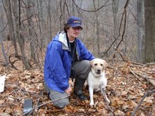
On the July long weekend I did an Adirondacks hike with OHOC. As a group we hiked up Mt. Marcy at 5344 feet making it the tallest peak in the Adirondacks. I spent much of the time hiking with Kevin Woodley as were of comparable strengths. On the second day I climbed Table Top at 4427 feet and Phelps at 4161 feet. Kevin climbed Colden at 4714 feet. While catching up on email at the Atlanta airport I received a email from Chris McDonald one of the leaders of the July trip to see if I wanted to climb a couple of more peaks. I shot back a quick email to say I was eager to climb a couple of peaks in the Keene Valley. Over the next couple of days we worked out the details of who would bring what gear. On Friday morning we started our journey to Lake Placid. We stopped in at EMS to rent a bear barrel which is now a requirement for overnight hiking. While waiting for ChrisMc and Kevin to sort out the barrel details I took a picture of Mirror Lake and called Jason to wish him a happy birthday on Saturday. Our next stop was to buy some last minute provisions. We would drive by the Heart Lake –Adirondack Loj access road and head south for about ten miles. Since our hiking would be done on herd path or unmarked trails we stopped in at the Mountaineer store to get some tips.
Once at the trailhead we loaded up Nalgene bottles and mounted our packs. (N44 06.729 W073 42.459) The first part of the trail was easy going until we missed a fork in the trail. After searching for a while we walked across the river and found the trail continued on the other side. The guide book said to take note of the Rock of Gibraltar so I stopped and had a couple of picture of me next to it. We would like for the three hours running the risk of setting up camp in the dark as sunset was at 7:00 pm. Much our time was spent hiking on either side of the Bouqeut River and constantly looking for the next carron. We soon left the river and started our climb. As the sun was setting the trail came to a sudden end. There was some discussion was to where we were. We had missed a campsite that we were going to use a reference point. We quickly set up our tents and ate store-bought subs for supper. The debate about our location continued and we decided to talk about it in the morning.
We were all up at 6:30. After a hot breakfast of oatmeal and tea we packed our gear. The access to East Dix (4026 feet) is via a rock slide that is about 800 yards long. Water dribbles down the slide and gave us a couple of pools in which pump water. ChrisMc was absolutely certain we had made a mistake somewhere along the hike. Gazing up at the slide it appears to be to short. We hiked down for 30 minutes and met up with the river again. I fired up the GPS and set the coordinates to UTM, ChrisMc pulled his compass and map and we studied the map. After checking and rechecking we were quite sure of where we were on the map. ChrisMc had underestimated the distance we had hiked (7.5 km/4.66 m). We decided to chance it and head back up to the slide. Once back at the slide we loaded up our daypack (REI UL Flash pack + 100 oz camelback + Nalgene bottle) with the gear and lunch we would need for the remainder of the days. It was at this point I got to know my colors a little better. Dark brown/black on rock is quite slippery while gray and white surface give you good purchase. Each of us took a different route and eventually reached the sub-summit at which point we met a well used trail. We hiked for a while before reaching the summit of East Dix (4026 feet) (N44 03.990 W073 45.413). We took a couple of pictures (solo, group) and then hiked over to South Dix along a well traveled path for about a mile. The hike to South Dix was filled with many switch backs which makes it hard to build any hiking speed. Along the way we hiked through an area where they had a blow down a couple of years ago. We stopped for lunch at the summit of South Dix (4068) (N44 03.587 W073 46.485) (pic 1) Lunch took the form of bagels, packaged tuna, carrots and fig newtons.
After lunch we started our descent into the valley that separated South Dix from Hough. We met two girls at the campsite midway that had climbed three of the four peaks that we had hoped to climb. They looked tired and beat up. There hike had started at 7:30 am from Elk Lake in the south. Over the next hour we would gain 400 feet and a rapid rate. There was a cool part of the climb I really liked. You had to take your pack off and slide sideways between two rock faces and climb up 25 feet. Once on top you could feel the full force of the wind. It was cold. We would climb for another 20 minutes before reaching the summit, a large rock (4409 feet) (N44 04.172 W073 46.667) I was forced to take off my hat as it the wind was whipping. At this point we decided not to attempt a climb of Macomb as we were short for time and it would be easily accessed from Elk Lake. Retracing our steps we hiked from Hough, to South Dix to East Dix. Before starting our descent of the slide we stopped for a Clif bar to rejuvenate. I was running low on water. I had drunk my camelback and half a nalgene bottle. Over in the distance there was some ominous black cloud. It looked like rain or snow. Just as we were starting our descent the cloud opened and it started to pore. ChrisMc and I sat underneath an overhang and waited out the rain. After clearing the sub-summit we each took a different route down to the base. I opted to head into the bush as soon as it was available. Trudging on brush gives you good traction as you hike down. This worked for a while until I mis-stepped a slipped on a black rock. I rolled as I was going down and landed on my bum and left pelvic. At a quick check over, I headed down the slide at a snails pace. Once back at camp I make some hot tea and munched on fig newtons. We were all relieved for a hot drink and something to stop the hunger pangs. Kevin and I cooked dinner which was combined three chili, bean and curry dishes. After dinner, I cut down a small maple and spruce tree. It was great to sit around the fire and reminisce about the day’s hike.
We were up at 7:30 to find that the weather had changed at it was a cool 40F. The hot tea and oatmeal were what was needed to warm us up. Once we were packed up we headed down the trail and were able to make good headway. I had set the GPS to count down the miles-to-the-car as reference marker and watched the distance diminish quickly. Before reaching the car we stop at a swimming hole and had a brisk swim. Once back at the car we changed into our street clothes and took a final picture. We stopped in at Keene Valley for a late breakfast.


|